Every street in Ingolstadt
Ingolstadt has 608 km of streets and paths. That is how much CLAYM knows for the city, and every street you walk, run or ride for the first time turns green on your map and earns points.
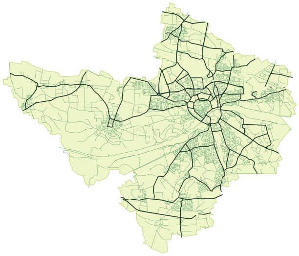
What kind of streets does Ingolstadt have?
This is how the 608 km split into kinds of street. A named street in Ingolstadt is 409 m long on average.
- Main roads142 km · 23 %
- Residential and side streets393 km · 65 %
- Traffic-calmed streets32 km · 5 %
- Pedestrian zones and squares2.6 km · 0.4 %
- Footpaths, cycle paths and tracks39 km · 6 %
What makes Ingolstadt different
- Only 6 % of the network are separate footpaths, cycle paths and tracks, less than in 234 of 280 cities on claym.me. Most routes follow streets.
- 65 % of the network are residential and side streets, more than in 215 of 280 cities on claym.me. Plenty of room for quiet loops away from traffic.
The districts of Ingolstadt
CLAYM assigns every street to the nearest district or locality. Piusviertel has the most, with 35 km, which is 6 % of the city.
- Piusviertel35 km
- Hollerstauden31 km
- Gerolfing29 km
- Etting28 km
- Mailing27 km
- Altstadt25 km
- Zuchering23 km
- Probierlweg18 km
- Kothau15 km
- Herz-Jesu-Viertel15 km
- Bahnhofsviertel15 km
- Konradviertel15 km
and 35 more districts and localities with 332 km together
How long would it take to walk every street in Ingolstadt?
At 5 km/h, 608 km are about 122 hours of pure walking, without detours, traffic lights or ways back. Walking one hour a day, you would have been everywhere after about 122 days, that is about 4 months. By bike at 15 km/h it would be about 41 hours.
Nobody has to do it all: in CLAYM every new street counts, and the map shows you which ones near you are still missing.
Ingolstadt compared
With 608 km, Ingolstadt ranks 56 of 185 cities in Germany on claym.me, and 4 of 25 in Bavaria. Augsburg (57 km away) has 299 km more streets and paths than Ingolstadt.
Cities nearby
Questions about Ingolstadt
How many kilometres of streets does Ingolstadt have?
According to the OpenStreetMap data CLAYM uses, Ingolstadt has 608 km of streets and paths, 1,487 of them with their own name. Pedestrian zones, footpaths and cycle paths are included, motorways are not.
Can you walk every street in Ingolstadt?
Yes, with patience: all 608 km take about 122 hours of pure walking. Walking one hour a day, you are done after about 122 days. CLAYM shows you which streets you are still missing.
Which district of Ingolstadt has the most streets?
Piusviertel with 35 km, ahead of Hollerstauden (31 km) and Gerolfing (29 km).
Is CLAYM available in Ingolstadt?
Yes, the streets of Ingolstadt are already in CLAYM. The app launches soon for iPhone and Android. Join the waiting list now to reserve your player name.
Reserve your name before it starts in Ingolstadt
CLAYM is coming soon to the App Store and Google Play. Sign up, reserve your name and we will let you know as soon as it launches.
- Your @name is blocked for everyone else
- One email at launch, nothing else
- Free, unsubscribe any time
Data as of 31 October 2026. Streets, city limits and districts from OpenStreetMap (© OpenStreetMap contributors), without motorways. Every street that earns points in CLAYM is counted. Rankings compare the 281 cities on claym.me.